Each member of our team knows that proper planning is necessary to ensure the quality of standard that SCR & Associates has come to be known for. Find out how we can help your project today!

Marine Surveying
Our dedicated aquatic’s division is more than capable of solving your bathymetric surveying needs. For over 40 years, SCR has worked with the FDEP to ensure every system meets compliance.

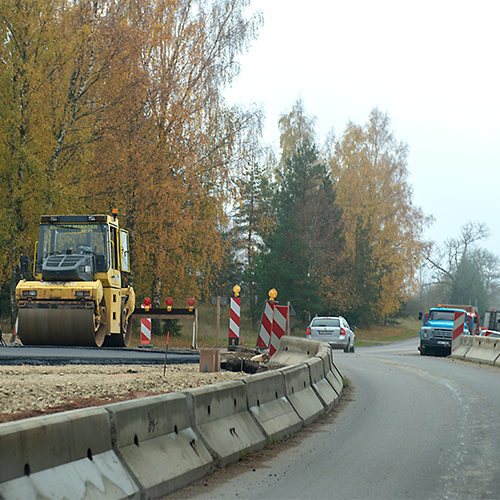
Infrastructure
With nearly half a century of experience in infrastructure projects, SCR has been building smarter cities. SCR & Associates are experts in utility engineering, traffic engineering, and right of way planning.

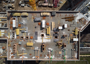
As-Built Surveys
Obtaining a certificate of occupancy? Accurate, trusted, and local is what you are looking for, and that is exactly what SCR & Associates will provide. Commercial or residential, we do it all.

Mapping
Our team uses UAV & GIS technology to provide some of the most accurate mappings that technology can provide. Do not make the mistake of not knowing your property lines.

GPS Surveys
SCR & Associates utilizes cutting edge satellite technology. Capable of providing measurements of two points more than 5-miles apart, and with a possible surveying accuracy down to an inch.
SCR & Associates Engineering Services
SCR & Associates provides clients with a professional and experienced team of engineers, surveyors, architects, planners, and support staff that are well practiced in supplying engineering, surveying, and planning services. SCR & Associates work to make sure that clients are confident in the planning & execution of their project, whether it be a multi-story bleeding edge theater hall, or a sidewalk repair near your home.
The term engineering is broad and covers many different disciplines that all share a common connection in that they center around the idea that through the use of scientific principles, the culmination of many pieces can form something greater than the parts of the whole.
SCR & Associates know each of these disciplines and provide exceptional quality by pulling on first-hand knowledge and experience.
Below you will find an incomplete list of the service areas we operate in. If there is service that you do not see listed please Contact Us and someone from our exemplary customer service team will be waiting to assist you.


SCR Engineering Services
- Storm Drainage Collection & Pumping Systems
- Water Distribution Systems
- Subdivision Planning & Design
- Floodplain Analysis
- Structural Assessment & Design
- Master Plans and Feasibility Studies
- Preparation of Design Standards & Specifications
- Transportation Engineering Services
- Water Engineering Services
- Wastewater Engineering Services
- Park & Recreation Engineering Services
- Land Development Services
- Commercial Developments
- Environmental Impact Reports
SCR & ASSOCIATE SURVEYING SERVICES
SCR & Associates’ surveying team provides Bay County, Florida and the surrounding areas with an extensive range of land surveying services, both conventionally as well as using cutting edge GPS technology. SCR knows that no two surveying needs are the same and with this knowledge SCR provides personal service to ensure your project stays on time.
SCR & Associate surveyors have helped with the completion of commercial buildings, government buildings, residential buildings, bridges, and much more. SCR & Associates are capable of serving as expert witnesses in legal disputes involving survey law and land disputes. Below are some of our more common practice areas, if you do not see your specific need listed below please Contact Us. No job is too large or small for SCR & Associates.
LAND SURVEYING
- Aerial Photography Control Survey
- Boundary Survey
- Elevation Certificate
- Flood Zone Certification
- Legal Descriptions
- Topographic Survey

MAPPING AND DESIGN SURVEYS
- Engineering Design Surveys
- Geodetic / Control Survey
- Rights of Way and Easements
- Volume Computations
- Utility Location Surveys
- UAV Aerial Mapping

GPS SERVICES AND CAPABILITIES
- GIS Mapping
- 3D Laser Surveys
- Road Profiles
- Utility Surveys
- Aerial Drone Surveys
- Control Surveys

CONSTRUCTION SERVICES
- Curb and Gutter Stakes
- Construction Staking
- Grading Certifications
- Horizontal Control Calculations
- Rough Grade Stakes
- As-Built Surveys

ASSET MANAGEMENT SERVICES
- Process Automation
- Database Design
- Custom Application Development
- Multiple System Integrations
- Field Asset Collection
- Drone Mapping & Services